The 14 most beautiful walks around Saint-Malo
The Saint-Malo region, jewel of the Emerald Coast, offers hiking enthusiasts an exceptional playground. Between the mythical GR34, nicknamed the customs path, and the many coastal trails, this Breton destination reveals its most beautiful natural assets. From the wild cliffs of Cap Fréhel to the breathtaking panoramas of the bay of Mont-Saint-Michel, via the secret coves of Cancale, every hike around Saint-Malo promises unforgettable discoveries.
200 audioguided tours for cities all around the world
DownloadDownload the audio tour to discover Saint-Malo on foot and on your own
Complete your walking experience by discovering the corsair town with Navaway’s Saint-Malo tour. This 6.2km interactive walk guides you through 29 places of interest in the fortified town, from the ramparts to the sea forts. Perfect for alternating between nature walks and urban discovery!
Also in the Saint-Malo guide :
- The 10 most beautiful beaches in Saint-Malo
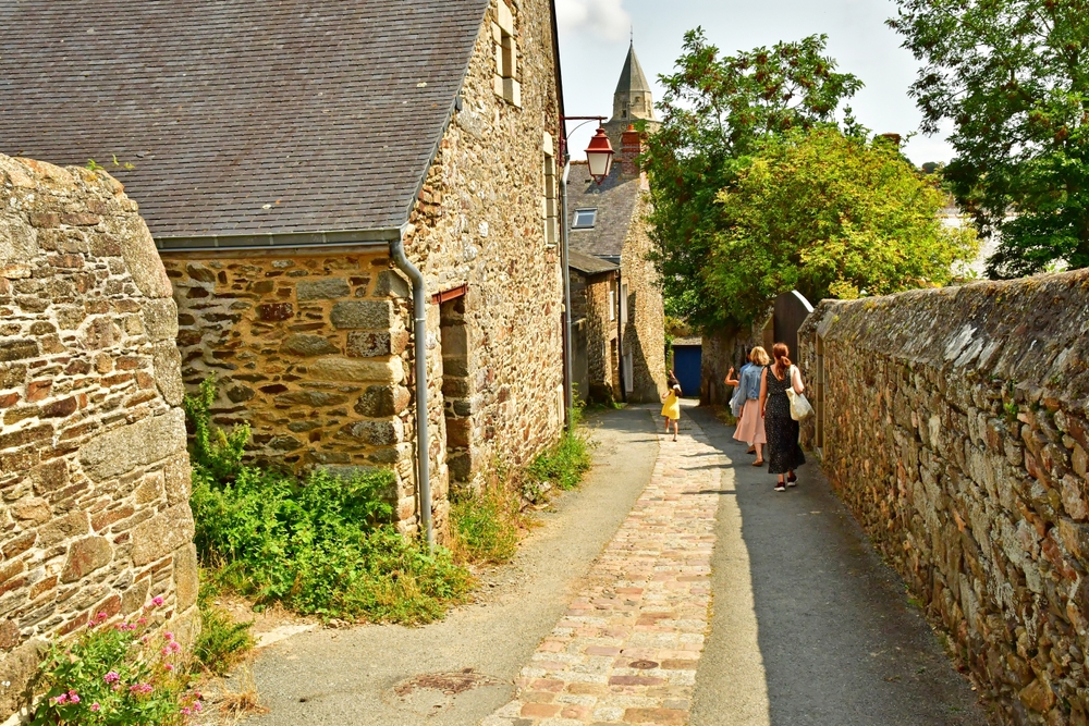
- The most beautiful villages to discover around Saint-Malo
- The best things to do in Saint-Malo
- Kouign-amann, crackers… the best culinary specialities to eat in Saint-Malo
- Solidor Tower
- Sculpted rocks at Rothéneuf
1. From Saint-Malo to Dinard along the coastal path
Distance: 14.8 km
Duration: approximately 3h30
Difficulty: Moderate
Difference in altitude: 286 m
This emblematic walk follows the route of the GR34 from the ramparts of Saint-Malo to the elegant seaside resort of Dinard. The route skirts the Emerald Coast, offering spectacular views over the Rance estuary. The route includes a crossing of the Rance dam, a remarkable feat of engineering that uses the tides to generate electricity. The views of Saint-Malo from the water are absolutely magnificent, especially at sunset. Arrange your own transport for the return journey, or take advantage of the bus links between the two towns.
2. Around the Pointe de la Varde and Rothéneuf areas
Distance: 8.4 km
Duration: approx. 2 hours
Difficulty: Easy
Difference in altitude: 89 m
Departing from Le Minihic beach, this family-friendly walk takes in the Pointe de la Varde and its breathtaking views over Saint-Malo. The trail leads to the famous Rothéneuf sculpted rocks, the fascinating work of Abbé Fouré, who spent 25 years carving more than 300 figures into the granite rock. These sculptures tell the legend of the Rothéneuf family of privateers and smugglers. Enjoy a swim at the Val beach, weather permitting.
3. Exploring the Pointe du Grouin from Cancale
Distance: 12.1 km
Duration: approx. 3 hours
Difficulty: Moderate
Difference in altitude: 271 m
This spectacular walk starts at the Petit Port beach near Cancale and leads to the wild Pointe du Grouin. This windswept rocky promontory offers one of Brittany’s finest views over the Bay of Mont-Saint-Michel. On a clear day, the silhouette of Mont-Saint-Michel is clearly visible on the horizon. Île des Landes, a nature reserve opposite the headland, is home to a large colony of gulls and cormorants. The Verger beach is an excellent stopping-off point for admiring the scenery.
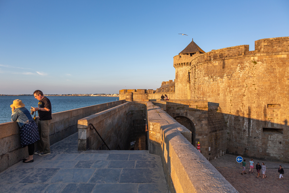
4. A complete tour of Saint-Malo and its forts
Distance: 6.9 km
Duration: approx. 1 hour 45 minutes
Difficulty: Easy
Difference in altitude: 86 m
This urban walk combines the discovery of Saint-Malo’s ramparts with the exploration of its maritime forts. The route takes in the Fort National at low tide, then the Grand Bé where Chateaubriand was laid to rest in accordance with his last wishes. A visit to the Petit Bé fort completes this journey through corsair history. Please note the tide times: the islets are only accessible at low tide. Be sure to check the tidal coefficients before setting off, and use the Navaway itinerary to guide you on your visit to Saint-Malo.
5. Around the pointe du Meinga
Distance: 4.2 km
Duration: approx. 1 hour
Difficulty: Moderate
Difference in altitude: 93 m
Don’t let the short distance of this walk around Saint-Malo fool you! The Pointe du Meinga, a wild rocky spur, has a few technical passages in the rocks that require caution and sure footing. Not recommended in wet weather or for those prone to vertigo, this walk rewards courageous hikers with breathtaking views of the Emerald Coast. The starting point, the Chevrets beach, invites you to relax after your effort.
6. Coastal walk along the bay of Mont-Saint-Michel from Cancale
Distance: 12.6 km
Duration: approximately 3h30
Difficulty: Moderate
Difference in altitude: 389 m
This 100% coastal walk offers uninterrupted views over the immense bay of Mont-Saint-Michel. The simple route follows the coastline from the famous oyster-farming town of Cancale to Port Mer, upstream from the Pointe du Grouin. Oyster lovers can stop off at one of the many establishments in Cancale to sample the famous flat oysters, a real local speciality. The trail offers breathtaking views of this UNESCO World Heritage bay.
7. The Minihic-sur-Rance loop
Distance: 11.7 km
Duration: about 3 hours
Difficulty: Easy
Difference in altitude: 180 m
This peaceful walk takes you on an exploration of the Rance valley, away from the hustle and bustle of the coast. The looped route mixes country landscapes and the banks of the estuary, offering a remarkable diversity. The paths skirt lush green meadows, pass through charming hamlets and reveal beautiful views over the maritime Rance. This walk allows you to appreciate the gentle Angevin atmosphere of this unspoilt valley, just a 22-minute drive from Saint-Malo via the Rance dam.
8. The Saint-Suliac loop
Distance: 10.6 km
Duration: approx. 2 hours 40 minutes
Difficulty: Easy
Difference in altitude: 202 m
Saint-Suliac, listed as one of the most beautiful villages in France, is the starting point for this magnificent walk on the other side of the Rance estuary. This fishing village of granite and schist houses has preserved its Breton authenticity. The coastal path climbs up to Mont Garrot for exceptional views over the estuary. Warning: some sections should be walked at low tide to avoid getting your feet wet.
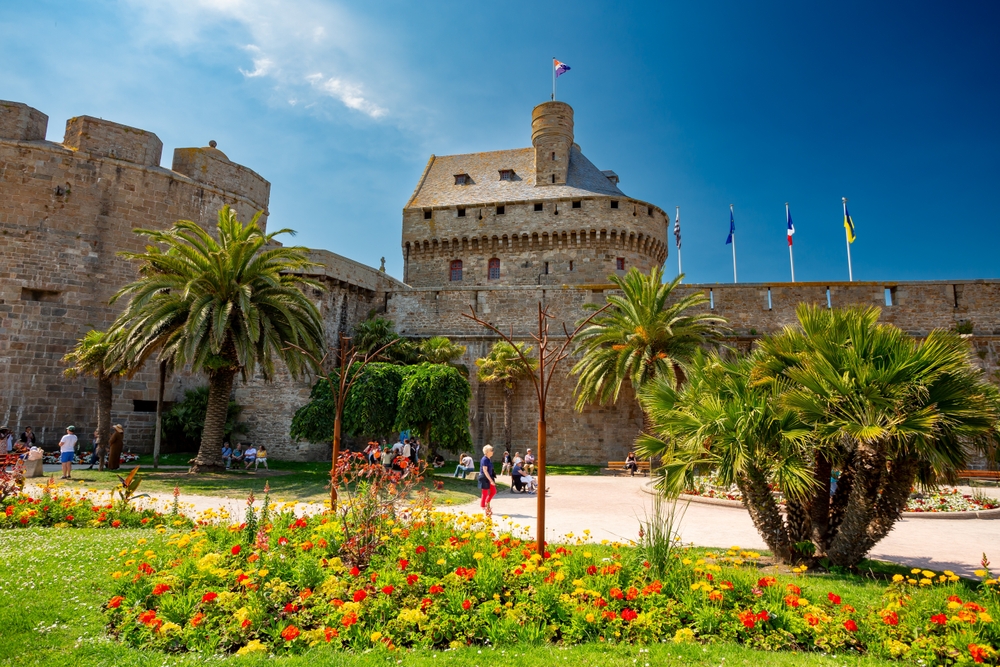
9. Cultural outing to the Cité d’Alet
Distance: 2.4 km
Duration: about 45 min
Difficulty: Easy
Difference in altitude: 48 m
This short historical walk explores the town of Alet, the original birthplace of Saint-Malo. Accessible on foot from the ramparts of Saint-Malo in 20 minutes, this wooded peninsula is a treasure trove of history. You’ll discover the 39-45 Memorial housed in a German blockhouse, the remains of the Gallo-Roman walls, Vauban’s citadel and the ruins of the former Saint-Pierre cathedral. The Tour Solidor, a 14th-century triple keep, offers magnificent views over the River Rance.
10. Saint-Malo seafront
Distance: 14.5 km
Duration: approximately 3h30
Difficulty: Moderate
Difference in altitude: 165 m
This walk starts directly from the ramparts of the corsair town and explores the seaside Saint-Malo. The route follows the line of the seafront up the beautiful beaches of Le Sillon, La Hoguette and Rochebonne. The opportunity to walk on the sand is a pleasant way to tone down the effort, while offering a unique sensation. Marine baths and Belle Époque villas line the route, revealing the elegant side of Saint-Malo. A refreshing swim is a must if the sun is shining!
11. A short tour of Ile Besnard
Distance: 1.6 km
Duration: approx. 30 min
Difficulty: Easy
Difference in altitude: 28 m
This family-friendly micro-route takes you around Ile Besnard, which closes off Rothéneuf harbour. Perfect for an outing with young children, it offers a breath of fresh sea air in an exceptional setting. The island offers great views of the coast and the surrounding oyster-farming facilities. Departure is from the Chevrets beach, ideal for a relaxing break at the end of the walk, with the possibility of supervised swimming in season.
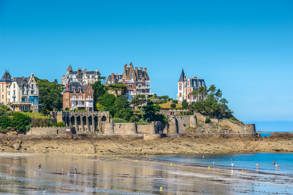
12. The Saint-Briac-sur-Mer loop
Distance: 16.7 km
Duration: around 4 hours
Difficulty: Moderate
Difference in altitude: 228 m
This beautiful walk starts from Saint-Briac-sur-Mer, a charming seaside resort just 25 minutes from Saint-Malo. The route first passes through the town, skirting the seafront and the emblematic Château du Nessay. The path then becomes more coastal, passing several beaches and rocky points. The views of Cap Fréhel and Saint-Malo are remarkable. After Saint-Lunaire, the return journey takes in the surrounding countryside, offering a pleasant diversity of landscapes.
13. Walk from Cap Fréhel to Fort La Latte
Distance: 9.6 km
Duration: approximately 2h30
Difficulty: Moderate
Difference in altitude: 150 m
This spectacular walk links two emblematic sites on the Emerald Coast. Cap Fréhel, with its pink sandstone cliffs rising 70 metres above the sea, offers one of the most breathtaking panoramas in Brittany. Its lighthouse, visible from 50 km away, has been guiding sailors since 1950. The customs path then leads to Fort La Latte, a 14th-century fortified castle perched on a rocky outcrop. This medieval fortress, the setting for numerous films, majestically dominates the Bay of La Fresnaye. The heather and gorse moors colour the landscape according to the season.
14. The Mont-Dol circuit and the Bay of Mont-Saint-Michel
Distance: 8.5 km
Duration: approx. 2h30
Difficulty: Easy to moderate
Difference in altitude: 165 m
This exceptional hike climbs Mont-Dol, a granite butte isolated in the middle of the polders of the Bay of Mont-Saint-Michel. From the summit (65 m), the 360° panorama stretches from Cancale to Mont-Saint-Michel, offering a unique perspective on this UNESCO World Heritage bay. The chapel of Notre-Dame-de-l’Espérance crowns a mountain steeped in legend, notably the battle between Saint Michael and the Devil. The footpaths wind between hedgerows and marshes, revealing the ecological wealth of this exceptional wetland.
In conclusion, the walks around Saint-Malo offer a remarkable diversity of wild coastal paths, cultural discoveries and breathtaking panoramas. Whether you’re a family walker or an experienced hiker, the Emerald Coast will win you over with the beauty of its landscapes and the richness of its heritage. And don’t forget to round off these natural discoveries with a visit to Saint-Malo on the Navaway audio tour, for a complete experience of this exceptional Breton destination.
FAQ
When is the best time to hike around Saint-Malo?
Hiking around Saint-Malo is possible all year round, but the period from May to September is ideal, with mild temperatures and less rainfall. Spring brings gorse and heather blooms, while autumn reveals magnificent colours on the coastal moors.
Is the GR34 difficult around Saint-Malo?
The GR34 around Saint-Malo is of moderate difficulty. It does not require any particular technical skills, but you will need to be in good physical condition for the longer stages. The gradients are reasonable, but the length of some sections and the coastal winds can increase the difficulty.
Is it necessary to check the tides for certain walks?
Absolutely! For a number of walks, you need to check the tide times, particularly for access to Grand Bé and Petit Bé, and for certain sections of the coastal path. Always check the tidal coefficients before setting off, and allow a safety margin for the return journey.
Where to park for walks around Saint-Malo?
Saint-Malo has several car parks: the Saint-Vincent car park near the gateway of the same name, or the Feval P14 car park further away but with free shuttle buses. For other tour departures, car parks are generally available in Cancale, Dinard, Saint-Lunaire and near the main nature sites. Arrive early in high season to find a space easily.
200 audioguided tours for cities all around the world
Download