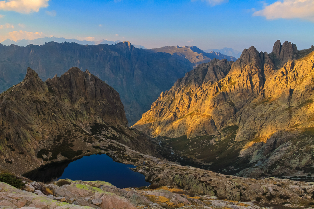
GR 20: discover Corsica’s legendary hike
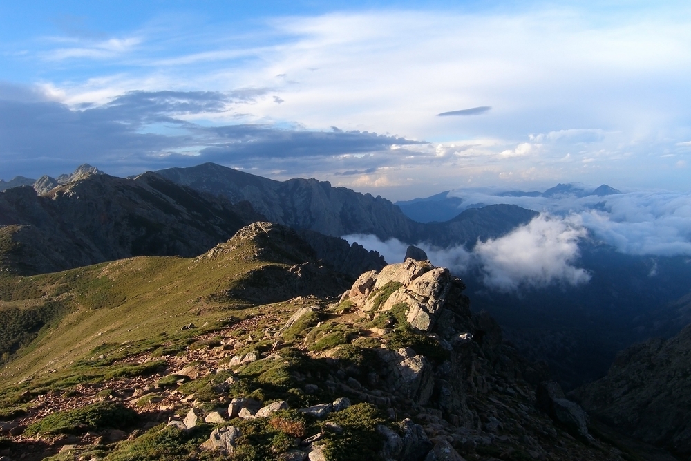
Crossing Corsica from north-west to south-east, the GR20 is considered to be one of the most difficult long-distance hiking trails in Europe. Around 180 kilometres long and with a total vertical drop of almost 10,000 metres, this legendary route attracts thousands of hikers every year in search of a challenge and breathtaking scenery. Between rugged mountains, glacial lakes and mountain refuges, the GR20 promises an unforgettable adventure in the heart of the Isle of Beauty.
See also the Corsica guide :
- Visit Ajaccio: the imperial city
- Visit Bastia: the pearl of the Île de Beauté
- What to do around Ajaccio in Southern Corsica
- Camping holidays in Porto-Vecchio: nature, relaxation and beaches in Southern Corsica
- The best places to visit in Haute-Corse
- The most beautiful villages in Corsica around Bastia
- 15 not-to-be-missed excursions around Ajaccio
- Corsica’s 10 most beautiful waterfalls for swimming
- The 10 most beautiful walks around Ajaccio
- Discover the 10 must-see places to visit in Corse-du-Sud
What is the GR20?
The GR20, also known as Fra li Monti (“through the mountains” in Corsican), is a long-distance hiking trail that winds its way through Corsica’s central mountain range. Recognisable by its characteristic white and red GR markings, the route traditionally links Calenzana in the north-west to Conca in the south-east, although it can be walked in either direction.
Created in the 1970s, the GR20 crosses some stunningly beautiful landscapes: rocky ridges, Laricio pine forests, high altitude lakes, glacial cirques and deep valleys. The trail crosses several of Corsica’s most emblematic peaks, including Monte Cinto (2706 m), the island’s highest point, and offers exceptional panoramic views over the Mediterranean.
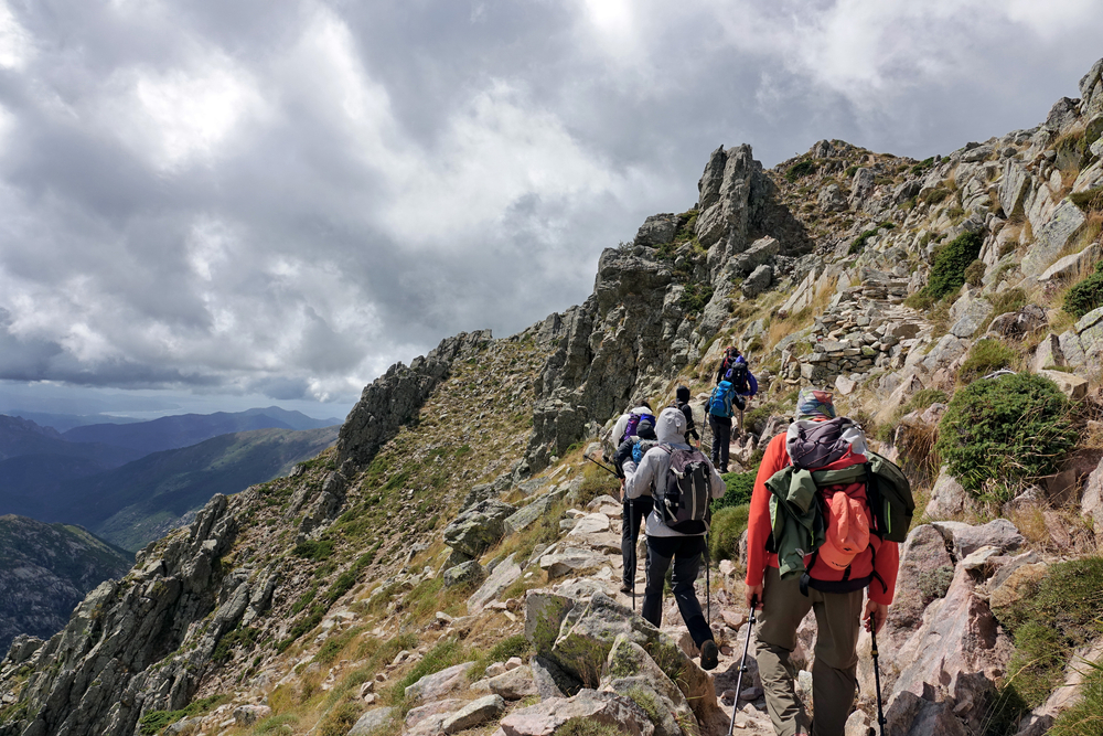
With its 180 kilometres and 10,000 metres of ascent, the GR20 requires excellent physical condition and experience of mountain walking. Its reputation as Europe’s most difficult trail is well-founded: rocky, rugged terrain, exposed sections, steep gradients and changing weather conditions are all part of the adventure.
The two parts of the GR20
The GR20 trail is naturally divided into two distinct sections, each with its own characteristics and levels of difficulty.
1. The GR20 North: from Calenzana to Vizzavona
Considered to be the most difficult and spectacular part of the route, the northern section of the GR20 starts in Calenzana, a small village in the Balagne region near Calvi. It ends at Vizzavona, a stopover village accessible by train right in the heart of Corsica.
This first half is characterised by technical and rocky paths, aerial passages with chains, and significant vertical drops. Hikers will discover breathtaking mineral landscapes, including the famous Cirque de la Solitude (now closed, with an alpine variant on offer), rocky ridges and the Aiguilles de Bavella. The GR20 North requires a good command of mountainous terrain and a lack of vertigo for some exposed sections.
2. The GR20 South: from Vizzavona to Conca
The southern section, although still demanding, is generally considered to be less technical but just as beautiful. It takes walkers from Vizzavona to the village of Conca, the gateway to Porto-Vecchio and the island’s south-east coast.
The GR20 South offers a more varied landscape, with dense forests, vast plateaux such as Coscione, and panoramic views over the Gulf of Porto-Vecchio. The paths here are less rocky, but the stages are still long and the gradient steep. This part of the route allows you to take in more of Corsica’s flora and fauna, with the chance to spot wild horses and mouflons.
The 16 stages of the GR20
The classic GR20 route is divided into 16 stages, which can be completed in as many days for moderately-paced hikers. Some seasoned sportsmen and women double the number of stages to complete the trek in 7 to 10 days, while others prefer to take their time and split up some of the particularly demanding days.
Stages of the GR20 Nord (from Calenzana to Vizzavona)
1. Calenzana – Refuge d’Ortu di u Piobbu
Distance: 12 km | Difference in altitude: 1,470 m | Duration: 6h
The first mythical and difficult stage gets you straight into the swing of things, with a steep climb to the refuge at an altitude of 1,570 metres.
2. Refuge d’Ortu di u Piobbu – Refuge de Carrozzu
Distance: 7 km | Ascent: 680 m | Duration: 5h30
Technical stage with rocky passages and chains, offering spectacular views of the Filosorma valley.
3. Refuge de Carrozzu – Refuge d’Asco Stagnu (Haut-Asco)
Distance: 6 km | Ascent: 790 m | Duration: 5h
A demanding route with the possibility of climbing Monte Cinto (2,706 m), the highest peak in Corsica.
4. Refuge d’Asco Stagnu – Refuge de Tighjettu
Distance: 6.5 km | Ascent: 840 m | Duration: 4h30
A short but intense stage, crossing the Col de Perdu and offering grandiose panoramas.
5. Tighjettu Refuge – Ciottulu di i Mori Refuge
Distance: 6 km | Difference in altitude: 580 m | Duration: 4h
Crossing the plateau of the same name, with the option of climbing Paglia Orba (2,525 m).
6. Ciottulu di i Mori refuge – Manganu refuge
Distance: 8 km | Ascent: 640 m | Duration: 7h30
A long and magnificent stage passing through Lake Nino, a glacial jewel surrounded by lush green meadows.
7. Manganu Refuge – Petra Piana Refuge
Distance: 8 km | Ascent: 760 m | Duration: 6h
Passage through the Melo and Capitello lakes, two high altitude lakes set in a rocky cirque.
8. Refuge de Petra Piana – Refuge de l’Onda
Distance: 7.5 km | Ascent: 490 m | Duration: 5h
Relatively short stage with descent to the Grottaccia sheepfold.
9. Refuge de l’Onda – Vizzavona
Distance: 14 km | Ascent: 710 m | Duration: 6h30
Last stage of the northern section, gradually descending towards the stopover village of Vizzavona, accessible by train.
Stages of the GR20 South (from Vizzavona to Conca)
10. Vizzavona – Bergeries de Capanelle
Distance: 15 km | Ascent: 890 m | Duration: 5h30
Back in the forest with a gradual climb towards the sheepfolds.
11. Bergeries de Capanelle – Refuge de Prati
Distance: 8 km | Ascent: 640 m | Duration: 6h
This stage crosses Monte Renoso with the possibility of a swim in the glacial lake of Bastani.
12. Refuge de Prati – Refuge d’Usciolu
Distance: 10 km | Ascent: 680 m | Duration: 6h
Crossing varied landscapes between forests and rocky ridges.
13. Refuge d’Usciolu – Refuge d’Asinau
Distance: 12 km | Ascent: 845 m | Duration: 8h
The longest stage of the GR20 South, passing over the Coscione plateau and Monte Incudine (2,134 m).
14. Refuge d’Asinau – Refuge de Paliri
Distance: 14 km | Difference in altitude: 430 m | Duration: 7h
A gradual descent with views of the famous Aiguilles de Bavella, spectacular rock formations.
15. Paliri Refuge – Conca
Distance: 12 km | Difference in altitude: 160 m | Duration: 5h
The last stage is a continuous descent to the village of Conca, marking the triumphant end of the GR20.
When should you set off on the GR20?
Choosing the right time of year is crucial to the success of the GR20. The best time to walk the trail is from late June to early September, when most refuges are open and staffed.
June: The ideal time for those seeking tranquillity. The trails are less busy and the temperatures are still pleasantly cool. Beware, however, of persistent snow at higher altitudes, particularly in the north. A good command of snow techniques may be necessary.
July-August: High season on the GR20, with many people visiting the refuges. Temperatures are high, making the climbs particularly demanding in the middle of the day. The advantage: generally stable weather conditions and all services operational. Huts must be booked several months in advance.
September: An excellent compromise between favourable weather conditions and moderate visitor numbers. Temperatures are milder again, the light is magnificent for photographers, and the atmosphere in the refuges is more relaxed. This is a particularly good time to do your first GR20.
Don’t: From October to May, the GR20 becomes a highly technical winter route, reserved for experienced mountaineers with appropriate equipment. Huts are closed, snow covers much of the route, and weather conditions become unpredictable and dangerous.
Level of difficulty and physical preparation
The GR20 is no ordinary hiking trail. Its reputation as the most difficult trail in Europe requires serious preparation, both physical and mental.
What level do you need?
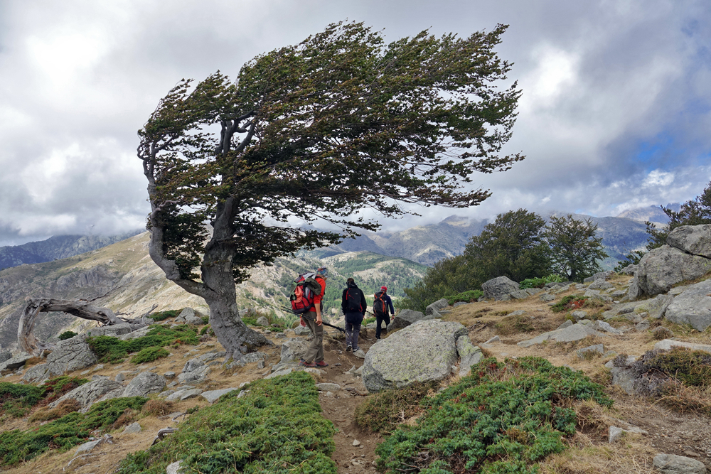
Excellent physical condition is essential. You need to be able to walk 6 to 8 hours a day with a rucksack weighing 10 to 15 kg, over rough terrain and with significant changes in altitude. Previous experience of mountain walking is strongly recommended, particularly to get to grips with rocky passages, chains and crossing névés.
The GR20 does not require any mountaineering skills as such, but it does demand a good level of comfort on rocky terrain, the absence of vertigo on certain exposed sections, and the ability to move independently in the mountains. Progression over rock and the use of chains are an integral part of the route, particularly in the northern section.
How do you prepare physically?
Ideally, start your preparation 8 to 12 weeks before departure. Typical programme :
- Training hikes: Increase the number of mountain outings you do, gradually increasing the distance and the gradient. Aim for 2 to 3 4-6 hour hikes a week, with a weighted pack.
- Muscle strengthening: Work your legs (quadriceps, calves), back and abdominal muscles in particular. Stair climbing, squats and sheathing exercises are your best allies.
- Cardio: Running, cycling, swimming: any endurance activity improves your cardiorespiratory capacity, which is essential at altitude.
- Acclimatising to altitude: If possible, do a few hikes above 2000 metres before you leave.
Don’t forget to include recovery weeks in your programme: alternate 3 weeks of intensive training with 1 week of relative rest to allow your body to recover.
Accommodation on the GR20
The GR20 has a network of refuges along the route, managed by the Parc Naturel Régional de Corse (PNRC). These refuges offer basic but much appreciated accommodation after a long day’s walking.
The refuges of the PNRC
Each refuge offers :
- Dormitories: Large wooden platforms equipped with mattresses (no blankets). Bring your own sleeping bag adapted to the cool mountain temperatures.
- Basic sanitary facilities: Dry toilets and drinking water points (usually a spring or fountain nearby).
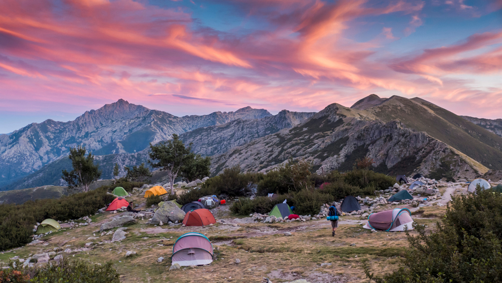
- Bivouac area: Tents can be pitched close to the refuge (for a fee, cheaper than the dormitory).
- Limited supplies: Sale of basic products (pasta, tinned food, energy bars) at high prices due to helicopter supplies.
Prices in 2024 (indicative): around €15 per night in a hut, €7 for a bivouac pitch. Booking required in high season via the PNRC website or by telephone, several months in advance for July-August.
Sheepfolds and private gîtes
In addition to the PNRC refuges, you’ll find a number of renovated sheepfolds and private gîtes along the route. These generally offer greater comfort (sheets provided, hot showers, hearty meals), but at higher prices. They are the ideal option for a night or two of rest during the trek.
Wild bivouacs: regulations
In order to preserve the fragile environment of the GR20, wild camping is prohibited between the refuges. You may only pitch your tent in the designated areas near the refuges. This rule is strictly enforced by the park wardens and rangers.
Equipment and gear for the GR20
The right equipment is essential for a successful GR20. Ideally, your pack should not exceed 10 to 12 kg (excluding water and food).
Essential equipment
Rucksack: 40-50 litres if you’re sleeping in a refuge, 50-60 litres if you’re bivouacking. Choose a model with good back ventilation and an effective waist belt to distribute the weight.
Hiking boots: High, waterproof and already broken in (risk of blisters otherwise). Spiked soles compulsory for grip on rocks.
Walking poles: Very useful for taking the strain off your knees on descents and keeping your balance on uneven terrain.
Sleeping bag: minimum comfort temperature 0°C, even in summer. Nights can be cool at altitude.
Technical clothing:
- Breathable technical underwear
- Short- and long-sleeved T-shirts
- Fleece or softshell for mid-season
- Light jacket for cool evenings/mornings
- Waterproof and breathable jacket (Gore-Tex or equivalent)
- Lightweight, breathable hiking trousers
- Shorts for hot days
- Gaiters (useful at the start of the season on snow)
Sun and head protection:
- Wide-brimmed hat or cap
- Category 3 or 4 sunglasses
- High protection sun cream (index 50+)
- Protective lip stick
First aid kit: anti-blister bandages (Compeed), disinfectant, painkillers, elastoplast, survival blanket, whistle.
Water and food: Water bottles or water pouches (2-3 litres total capacity), water purification tablets, energy food (bars, dried fruit, chocolate).
Navigation: IGN map of the GR20 (Top 25), compass, mobile phone with offline mapping application (VisoRando, IGNRando).
Miscellaneous: Headlamp with spare batteries, multi-purpose knife, lighter, toilet paper and bin bag, external telephone battery.
If you’re bivouacking
Add: lightweight tent (maximum 2 kg for one person), insulating mattress, stove and cooking utensils, freeze-dried or dehydrated food.
Food and supplies
Managing your diet is a key factor in the success of the GR20. Energy expenditure is considerable: count on between 3,500 and 5,000 calories a day, depending on your size and the intensity of the effort.
Food in the refuges: All the refuges with wardens sell basic foodstuffs, but at high prices (2 to 3 times the normal price) and with a limited choice. You’ll generally find pasta, rice, tinned food, cheese, cold meats, fresh bread, energy bars, dried fruit and chocolate.
Stage villages: Vizzavona (stage 9) has a grocery shop where you can stock up for the second part. Some refuges also offer prepared meals on reservation.
Recommended dietary strategy:
- Leave with 2-3 days of food from Calenzana
- Fill in the details in the refuges as you go along
- Stock up on supplies at Vizzavona for the southern section
- Favour light energy foods: dried fruit, nuts, cereal bars, chocolate, etc.
- Plan warm meals in the evening to help you recover: pasta, rice, semolina with a protein supplement.
Water: Drinking water points at each hut (springs, fountains). Between refuges, a few springs are indicated on the maps, but check their condition with the wardens. Always carry 2 to 3 litres of water, more in hot weather.
Travelling alone or accompanied?
The question of whether to set off on the GR20 alone or in a group is worth considering, as each option has its advantages and disadvantages.
Going it alone
Advantages: Total freedom of pace, breaks and departure times. Possibility of modifying your itinerary to suit your mood. A highly introspective experience.
Disadvantages: Reduced safety in the event of an accident or health problem. Weight of bag cannot be shared. Can be psychologically difficult when tired.
Tip: The GR20 is busy enough in season that you’re never really isolated. Many friendships are made in the refuges, and it’s easy to walk a little way with other hikers you meet there.
Group travel
Benefits: Increased safety, moral support in difficult times, sharing of collective equipment (tent, stove), convivial experience.
Disadvantages: Need to agree on walking pace, risk of tension if physical levels are too different.
Tip: Make sure your group is evenly matched in terms of fitness and motivation. Two to four people is the ideal number. Beyond that, the logistics become complex (booking refuges, managing different paces).
With a guide or on your own?
A number of specialist agencies offer guided treks on the GR20, with luggage transport and complete organisation. This safe option is particularly suitable for those new to the high mountains or those who want to enjoy the landscape to the full without worrying about logistics.
Experienced hikers will generally prefer total autonomy, which is more rewarding and allows them to really immerse themselves in the GR20 adventure.
Must-see points of interest on the GR20
As well as its sporting achievements, the GR20 offers exceptional landscapes and remarkable natural sites along the way.
1. Cirque de la Solitude (closed – alpine variant)
Long considered the most technical section of the GR20, the Cirque de la Solitude is now officially closed following several fatal accidents. An alpine variant has been developed, safer but still impressive, with chains and very exposed terrain.
2. Lake Nino
The real pearl of the GR20, Lac de Nino (1,743 m) is a glacial lake surrounded by pozzines, wet grasslands typical of Corsica where horses and cows graze in semi-liberty. The contrast between the turquoise water of the lake and the bright green of the meadows is striking. A 30-minute off-trail diversions from the Manganu refuge will take you to this magical spot.
3. Melo and Capitello lakes
Accessible on stage 7, these two glacial lakes set in a rocky cirque offer an imposing spectacle. Lake Melo (1,711 m) is easy to reach, while Lake Capitello (1,930 m) is higher and wilder, requiring a little extra climbing.
4. Monte Cinto
The highest peak in Corsica at 2,706 metres, Monte Cinto can be climbed from the Asco Stagnu refuge (stage 3). This off-GR climb takes 3 to 4 hours round trip and offers an absolutely breathtaking 360° panorama of the whole island and the Mediterranean.
5. The Coscione plateau
A vast green expanse at an altitude of over 1,400 metres, the Coscione plateau offers a radically different landscape to the rest of the GR20. These vast high-altitude meadows, dotted with pozzines and streams, are home to wild horses and Corsican cows.
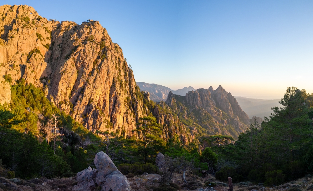
6. The Aiguilles de Bavella
These spectacular rock formations, resembling stone cathedrals, dominate the end of the GR20 Sud. Their jagged silhouettes against the sky are one of the most photographed panoramas in Corsica. The GR20 passes at the foot of these needles on the penultimate stage.
Variants and alternatives to the GR20
If the full GR20 seems too demanding, or if you want to discover Corsica in a different way, there are several alternatives.
Do only part of the GR20
Many hikers choose to cover just one section of the trail, generally the GR20 Nord (Calenzana-Vizzavona), considered to be the most spectacular. This option allows you to discover the essence of the GR20 in 7 to 9 days.
Mare a Mare trails
Corsica offers three Mare a Mare (“from sea to sea”) routes that cross the island from east to west, offering a less technical alternative to the GR20:
- Mare a Mare Nord: From Moriani to Cargèse in 11 days
- Mare a Mare Centre: From Ghisonaccia to Porticcio in 7 days
- Mare a Mare Sud: From Porto-Vecchio to Propriano in 5 days
These trails, which are less busy and less physically demanding, allow you to discover authentic Corsica, passing through many traditional villages.
Mare e Monti trails
Mare e Monti (“from the sea to the mountains”) routes combine the coast and the mountains:
- Mare e Monti Nord: From Calenzana to Cargèse in 10 days
- Mare e Monti Sud: From Porticcio to Propriano in 5 days
These trails offer a wide variety of landscapes at a level of difficulty accessible to all.
Safety and practical advice
The Corsican mountains are no place for improvisation. A few essential safety rules for a successful GR20:
Before you leave
- Take out repatriation insurance and check the cover provided by your bank card
- Inform your family and friends of your itinerary and planned dates
- Check the weather forecast and snow conditions
- Check when huts are open and make your reservations
On the trail
- Leave early in the morning (6am-7am) to avoid the afternoon heat and thunderstorms
- Keep to your own pace, don’t try to keep up with faster hikers.
- Hydrate regularly (1 litre of water every 2-3 hours)
- If in doubt about the route, ask other hikers or turn back.
- Follow the signposts and don’t try any risky shortcuts
- If you’re tired, don’t hesitate to split a stage or take a day off.
Emergency numbers
- 112: European emergency number (works even without your operator’s network)
- 18: Fire brigade
- 15: SAMU
- 04 95 61 13 95: PGHM (Peloton de Gendarmerie de Haute Montagne) of Corsica
Important information: The telephone network is uneven on the GR20. Some areas are covered, others not. In an emergency, climb to a higher altitude to try and get a signal.
Weather and natural hazards
The weather in the Corsican mountains can change very quickly. Summer thunderstorms are frequent in the afternoon and can be violent. In the event of a storm :
- Immediately descend the ridges and summits
- Keep away from isolated trees and watering holes
- Squat down on your rucksack, feet together
- Keep away from all metal objects (sticks, ice axes)
Rock falls are common, particularly after heavy rain. Be careful in the corridors and under the rock faces.
Respect for the environment
The GR20 crosses the Parc Naturel Régional de Corse, an extremely fragile protected area. Here are a few essential steps you can take to preserve this exceptional natural heritage:
- Don’t leave any rubbish behind: take everything back with you (paper, packaging, cigarette butts). Organic waste (peelings, cores) takes a very long time to decompose at altitude.
- Use the toilets in the refuges and avoid relieving yourself in the open. If necessary, move away from paths and waterholes (minimum 50 metres), dig a hole and cover it up.
- Don’t pick flowers or disturb wildlife
- Stay on marked paths to avoid erosion
- Respect the quiet zones and the tranquillity of the site
- Save water, a precious mountain resource
- Never light a fire: extremely high fire risk in Corsica
The principle of “Leave No Trace” should guide your every move on the GR20.
Budget for the GR20
Preparing a realistic budget is important if you want to tackle your GR20 adventure with peace of mind.
Transport:
- Plane to Corsica: €100-400 depending on the season and how far in advance you plan to travel
- Airport-Calenzana transfer: €50-80 (taxi or shuttle)
- Return Conca-airport: €80-120
Accommodation and meals (for 16 days):
- Nights in refuge: €15 x 15 nights = €225
- OR Bivouac: 7€ x 15 nights = 105€ + camping equipment
- Food supplies: €15-20/day = €240-320
- Meals in refuges/shelters (occasional): €15-25/meal
Equipment:
If you have to buy everything: expect to pay €800-1500 for a full set of quality equipment (rucksack, boots, technical clothing, sleeping bag, etc.). You can hire or borrow equipment to reduce costs.
Estimated total:
- Tight budget (bivouac, own kitchen): €800-1000
- Comfortable budget (shelter, some meals): €1200-1500
- Budget with luggage and guiding: €2,000-3,000
Before and after the GR20: discovering Corsica
Make the most of your visit to Corsica to explore the treasures of the Isle of Beauty before or after your hike. Navaway offers audio-guided tours of Corsica’s most beautiful towns.
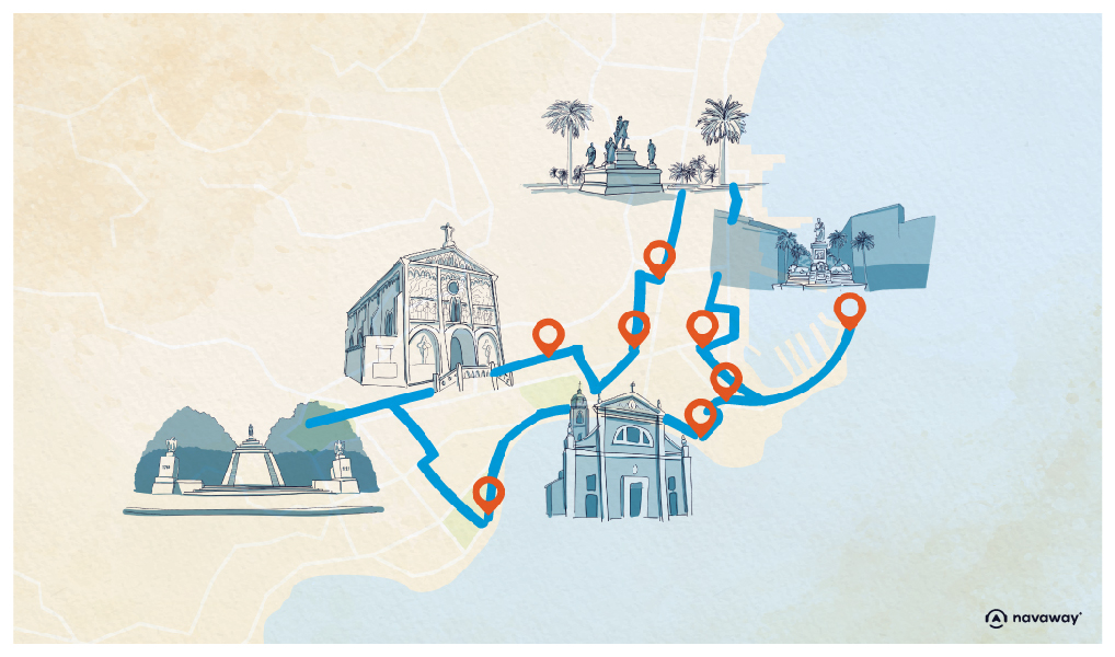
Download the audio tour to discover Ajaccio on foot and on your own
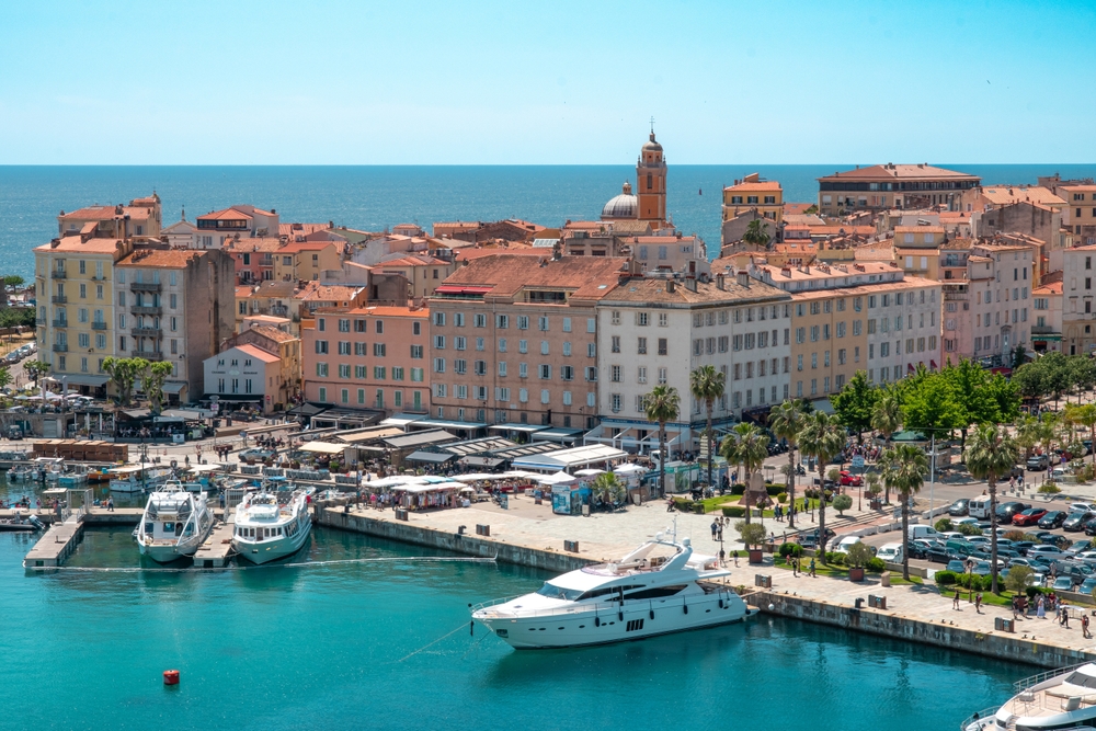
Visiting Ajaccio, the imperial city, is the perfect opportunity to immerse yourself in Corsican and Napoleonic history. The capital of southern Corsica has a seductive Mediterranean atmosphere, with colourful old streets, a lively port and sandy beaches. Thanks to the Navaway audio tour, you can explore the Maison Bonaparte, the Santa-Maria Assunta cathedral, the citadel and Ajaccio’s famous market on your own. The app guides you through 18 points of interest with fun audio guides and captivating historical anecdotes. After the effort of the GR20, there’s nothing like a gourmet break in an Ajaccio restaurant to sample Corsican specialities: charcuterie, cheeses, veal with olives and fiadone. Don’t forget to make a diversion to the Sanguinaires islands, accessible by boat from Ajaccio harbour, to admire an unforgettable sunset over the Mediterranean.
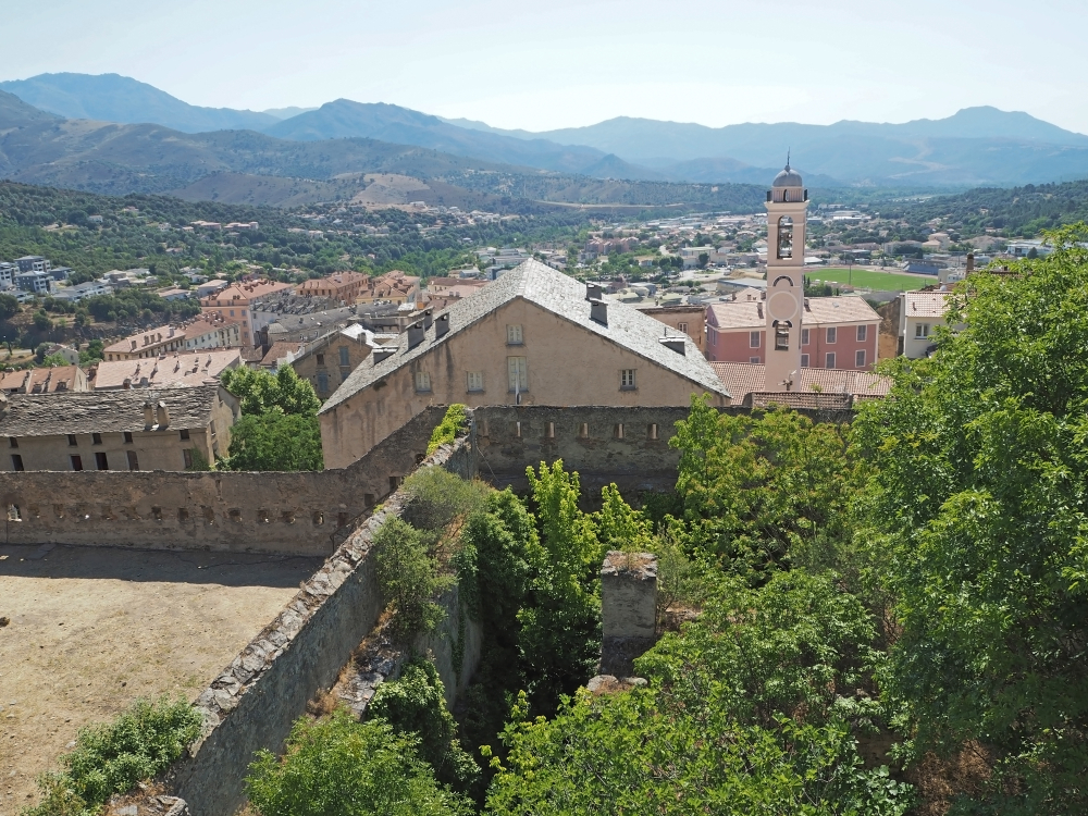
In the north of the island, Visiter Bastia immerses you in authentic Corsica, with its picturesque Old Port, Genoese citadel and typical colourful facades. The Navaway tour of 21 audioguides takes you on a tour of the Place Saint-Nicolas, the Saint-Jean-Baptiste church and the Romieu garden. Bastia is also the ideal starting point for exploring Cap Corse, this wild peninsula of hilltop villages and Genoese towers, or for reaching Calenzana, the starting point of the GR20 Nord, just 30 minutes away.
Whether you arrive via Ajaccio-Napoléon Bonaparte or Bastia-Poretta airport, take the time to acclimatise for a few days before tackling the GR20, and make the most of the opportunity to discover these emblematic towns with the Navaway audioguide itineraries, which guarantee you an enriching, self-guided visit.
In conclusion, the GR20 is much more than just a hike: it’s a real human and sporting adventure in some of the most spectacular scenery in Europe. From physical challenges to total immersion in the wilds of Corsica and the discovery of friendly mountain huts, this legendary trail will leave you with unforgettable memories. Whether you choose to walk the whole route or just a section, whether you opt for the comfort of the refuges or the autonomy of the bivouac, the GR20 promises an unforgettable experience. Prepare seriously, respect the mountains and Corsican nature, and let yourself be carried away by the magic of this legendary route. And don’t forget to round off your stay in Corsica with a visit to Ajaccio or Bastia, thanks to the Navaway audio tours, for a complete and rewarding discovery of the Isle of Beauty.
FAQ: your questions about the GR20
How long does it take to do the GR20?
The GR20 is usually completed in 15 to 16 days, with one stage per day. Highly trained hikers can complete it in 7 to 10 days, doubling the number of stages, while others prefer to take 18 to 20 days to take full advantage of the scenery and recuperate between difficult stages.
Do you have to be a great sportsman to do the GR20?
Excellent physical condition is essential, but you don’t need to be a top-level athlete. The most important thing is to have good stamina, be used to walking in the mountains with a difference in altitude, and to prepare yourself thoroughly 2 to 3 months before setting off. The GR20 has to be earned, but it remains accessible to any motivated and well-prepared hiker.
Is it possible to do the GR20 without booking huts?
In July and August, hut bookings are compulsory and must be made several months in advance via the PNRC website. Out of high season (June and September), it is sometimes possible to find a place without booking, but it is risky. Bivouacking at dedicated sites near the refuges is an alternative, which also has to be paid for, but is often less overcrowded.
Which way is easier: North-South or South-North?
The north-south route (Calenzana to Conca) is the busiest and considered the “natural” route. It places the most technical sections at the start of the route, when you’re fresh. The South-North route is slightly easier because the southern part is less technical, allowing you to get into the swing of things gradually before tackling the northern part. This route is also less busy, offering more peace and quiet.
Is it possible to leave the GR20 en route?
Yes, there are several exit points off the trail: Vizzavona (stage 9, accessible by train), Bavella (stage 14), or by taking the variants that descend towards the villages. If you have to give up for medical reasons or because you are tired, the refuge wardens can help you organise your evacuation. Repatriation insurance is strongly recommended.
Is there a telephone network on the GR20?
Network coverage is very patchy on the GR20. Some refuges and summits have good reception, but other areas are totally isolated. Don’t rely on your phone for navigation (download offline maps) or to stay in constant contact with your loved ones. Expect them to hear little from you during your trek.
How much does the GR20 cost?
Excluding personal equipment, allow between €800 and €1,500 per person to complete the GR20 on your own (transport, accommodation in mountain huts or bivouacs, food). The budget rises to €2,000-3,000 if you opt for an organised trek with a guide and luggage.
What is the most difficult stage of the GR20?
Stage 4 (Asco Stagnu – Tighjettu) via the alpine variant (ex-Cirque de la Solitude) is often cited as the most technical, with its chains and exposed sections.Stage 13 (Usciolu – Asinau) is the longest, with an 8-hour walk and Monte Incudine to cross. But difficulty is subjective and depends on your physical condition and the day’s weather.
200 audioguided tours for cities all around the world
Download